The summer of 2023 so far, has been unusual. “Warm and sticky” might be a two word description. The unstable air created beautiful cloud patterns reminiscent of Puerto Rico, or Ireland, but very unusual for Long Island. The white cloud masses rose up each day into giant towering thunderheads, (Cumulonimbus ) then the sky darkened and heavy showers followed. This is a sure indicator that the air is heavy laden with moisture.
Looking back, winter was very mild too, except for one record shattering cold day, that froze my friend Gus’ beloved fig trees. Spring also arrived early, and was brief—someone called it “ephemeral”. Spring season quickly morphed into deep summer—but it did so in late May. Calendrical summer did arrive on June 21, but it was hot and humid, more like August than June. Each day opened with persistent 99% relative humidity which fed the daily thunderheads. Other unusual occurrences: the Goldfinches never arrived, nor did the hummingbirds. Our sticky, red and drippy “hummer” feeders dangled in the hot sun as ignored as was our our well-planned and tediously tended flower beds, now burgeoning with red blossoms—planted just for this species. Where are they? With this weather the hummingbirds probably found so much nectar sources further south, they never bothered to come north to our place.
So what’s going on?
Climate fanatics love to mix up climate and weather. Some continued to blame the summer’s heat and humidity on “Global Warming”, a climatic phenomenon. But climate and weather are distinct and very different sciences. Weather is highly varied and that variability is still poorly understood. Are the weather phenomena we experiencing simply natural variability in weather—or is it related to a warming planet? We do not know. Smudging up the difference between the two simply ignores actual causes—aspects of the atmosphere that must be understood to be addressed.
Though human-caused climate warming is real —it is not the sole cause of every unpleasant event in our universe. Meteorologist conclude that our strange summer of 2023 is 99% a weather phenomenon——called the equatorial oscillation or El Niño!
So we are experiencing an El Nino event of the equatorial region. Over a period of from 3-7 years La Niña weather tends to cycles through to El Nino. El Nino weather is generally shorter, sometimes lasting only about a year. La Nina events last longer.
The last El Nino we experienced here was in 2014 -2016 when records were set for the warmest years on record. A “neutral” period intervened but, since 2019 we have had three successive La Nina years. But 2023 has arrived with what seems a strong “El Nino”.
https://www.climate.gov/news-features/blogs/june-2023-enso-update-el-niño-here.
The term El Niño (“the little one”) is derived from observations Peruvian and Ecuadorian fishermen made concerning their fishing success. They noticed that on some years, around Christmas—(the birth of Jesus when “El Niño” arrives) Pacific sea water temperatures rose sharply..and fishing went bad.
In most years cold water up wells from the deep, off the the Pacific east coast of Ecuador and Peru. The upwelling of cold deep water brings nutrients from the depths and microscopic sea life to feed on it. Fish follow. But some years around Christmas (or the arrival of “El Nino”) the ocean was capped with warm sea water, no upwelling, and no fish.
What caused the warm water arrival? What are the weather impacts of El Nino?
El Nino event of this year began with the arrival of a great flood of equatorial warm water which pooled up off the west coast of Ecuador and Peru close to the equator.
Today (7-15-‘23) sea water surface temperature in that equatorial region where the Galapagos Islands occur is exactly 78F. That temperature is about 5 degrees higher than it was last year on the same date. Seventy-eight degrees Fahrenheit (78F) is a pleasant temperature for human swimmers and desirable pool/water level, but is not good for sea water, or fish. The oxygen content of water, or oxygen saturation, drops off as water temperature rises. Since warm water is less dense than cool water, warm water at the surface creates a stable temperature situation which inhibits mixing of the top warm layer with cooler layers below.
The warm top layer soon becomes deficient in oxygen. Nutrients quickly get used up, and can not be replaced. And in a very short time the sea off Ecuador and Peru becomes almost barren of life.
Why does the water warm arrive?
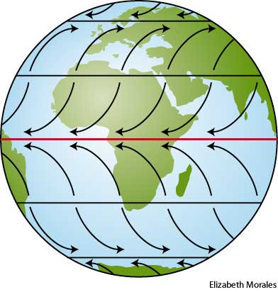
In the eastern Pacific off the coast of Peru and Ecuador, the North East Trade Winds and South East Trades, major elements of the Earth’s global winds circulation pattern, flow west toward Japan. See Trade Winds The constant flow of air over the water “pushes water in that direction” and tends to create a surface current which moves Pacific surface water at the equator west toward Japan. This flow of water toward Japan causes the desirable upwelling of cold deep water along the coast of Ecuador and Peru. This upwelling is the source of those nation’s wealth in fish resources. Simply stated it is the Trade Winds which push warm surface water toward Japan.
During the last three La Nina years we have had strong Trade Winds or northeasterly winds near the equator. These winds have effectively pushed warm equatorial water WEST over these last years to accumulate and “pile up” IN THE EAST PACIFIC OCEAN off of Japan, the Philippines and Indonesia. Warm water has accumulated there for three years now.
During the La Nina years 2014 -2016 these constant northeast winds have caused sea levels to rise off Japan by 20 cm, or almost 8 inches.
During a La Nina years warm water piles up in the western Pacific. Eight inches in height seems a very minimal slope when measured over the 9,000 mile wide Pacific but even small forces can move liquids like water very effectively. As a result of less powerful Trade Winds and this higher level of warm water on the Japan side of the Pacific and lower on the Ecuador side…warm water has flowed back east this year…and brought on an El Nino. The Trade Winds push water west toward Japan, cause upwelling and La Nina effects, then when the winds weaken the water flows back to produce the El Nino effect.
During an El Nino annual event very warm sea water collects off Ecuador, SA and surrounds the Galapagos Islands. It stagnates there, warming the air and raising the level of moisture in the air.
This pool of warm water has a great effect on the global wind circulation. Global winds generate the jet streams which initiate and guide cyclonic mid-latitude storms. See: Jet Streams
During an El Nino event the warm water pool in the Eastern Pacific tends to drag the Mid Latitude Jet Stream (MLJS) south closer to the equator, displacing it from a more northerly position. https://www.noaa.gov/jetstream/enso_impacts El Nino’s displaced jet also causes higher temperatures in some places, floods in others and severe droughts in other areas. Weather patterns are responding to a jet steam that is out of its “normal” pattern or where we would expect it to be.
Under El Nino circumstances the Mid Latitude Jet stays more southerly. In this location it picks up moisture from the Pacific and moves it east. The result is higher temperatures and more moisture in the air over Texas, the Gulf States, southern USA and parts of the Mid Atlantic States. As the jet swings out over the Atlantic it also tends to suppress Atlantic Hurricanes. But its effects in the west, is to intensify Pacific hurricanes or typhoons.
In the USA we should expect wetter than average conditions all along the Gulf Coast and possibly along the east coast. And expect the Pacific Northwest and the Ohio Valley regions to be cooler and drier than normal.
If El NIno hangs around till winter, we will discuss the weather effects of a winter El NIno.
No comments:
Post a Comment